ACCESS
There are numerous access points to the site which have been difficult to control and have provided easy and quick exit from the residential side of Seacroft. However following the opening in 2024, of the Skegness to Gibraltar Point section of the King Charles 111 Coast Path Kissing gates have been installed along the full length of the Marsh.
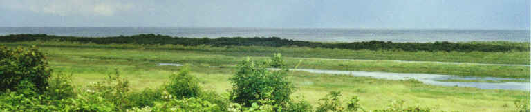
Lagoon Walk and South Parade Car Park
Additional signs erected in July 2004 and updated more recently, have undoubtedly raised awareness and most illegal vehicles enter the site from this direction. The new locked gate and pedestrian kissing gate limit access against the dunes but are easily bypassed over the picnic area.
Drummond Road
Time will tell how effective the new kissing gates perform - Access is limited and may stop some larger persons from entering and pose problems for holiday makers with buggies and pushchairs. No disabled access to the seashore for the whole of Seacroft.
Seacroft Esplanade
Since the barrier was erected at the end of the Esplanade and the signs placed along the roadside there are very few problems at this end.
Beach Access
On occasions vehicles access the beach further north and simply drive through the dune breach or over the outer dunes. Many illegal activities are confined solely to the beach and these are covered below.
It may be that, to fully protect the site, further signage needs to be installed at all beach entry points limiting southerly travel and a permanent large sign placed in the sand opposite the end of Beach Road.
PUBLIC ABUSE
There is little doubt that general abuse by the public has a detrimental effect on the site and it easy to find evidence of previous vehicle damage, some having occurred many years ago. Not all is so obvious, as many activities simply dislodge wildlife and push it away from the site and it is particularly important to avoid this when birds such as skylark are nesting on the marsh and ringed plover on the shingle.
There has been a substantial increase in various wind sport activities along the beach and little understanding from the participants about this protected area; the public are not generally aware that this protection extends to the mean low water mark. As the extreme sports market continues to rapidly expand, it may be that Skegness, as a premium resort, will have to designate a specific area of beach to such activities. In the past as many as nine chute driven vehicles have been seen racing along the sand not only driving away most roosting and feeding birds but also posing a very real danger to other beach users. Persistant contact and the tightening of the Council's lease agreements had almost eliminated this sand based activity by the end of 2006 but this has been on the increase again in the last three years. (It appears that many other resorts, having designated such areas are in fact benefiting from the increased tourism that the publicity generates.)
Kite sports have continued to grow and as many as eleven have been noted in the sky at any one time used mainly for surf boarding and free flying from the beach. During the Tern breeding season the returning parents have been seen making large detours to miss such activity and some may have failed to return although there is no data to support this at present.
The following vehicles and activities have been observed on the marsh, beach and dune system at one time or another. All these issues could be addressed with the formulation of local bye-laws and a regular Warden/Ranger presence.
4Wheel Drives
Cars
Quad Bikes
Tri Bikes
Motorbikes
Scramble Bikes
Electric Scramble bikes (particularly dangerous as they travel at great speed and almost in silence)
Mini bikes
Bicycles
Mountain Bikes
-Land yachts, boards, and mountain boards, wind driven by chute, kite and sail.
-Powered hang gliders, rigid and chute.
-Bait digging, particularly in the creeks on the marsh.
-Camping and in particular lighting fires.
-Long term camping by vagrants - in 2006 up to 7 vagrants in various dune locations persistently for more than 6 months. No action by police or ELDC to either move them or clear away the large volume of rubbish left on site. Again in 2012 persistent campers remained on site for 7months before the Anti Social Team took action. Almost 20 years on 1n 2024,regular campers could be found and if they claimed that camping is their lifestyle choice, they are left by the Council.
-Collecting plants and flowers and in particular collecting samphire. Large numbers of Asian visitors can be seen round about the August Bank Holiday weighed down with large carrier bags full of samphire and it is understood that much of this is sold in the midlands on their return.
-Horse riding both on the beach and the marsh. (In recent years this seems to have stopped)
-Dumping of garden waste and introduction of alien species.
-Beach Ferry (Currently not in use) - the same constraints put upon the vehicle whilst driving on the NNR must be adhered to throughout the full length of the SSSI.
-Police Buggy – liaison with the police necessary to ensure they adhere to guidelines for use of their vehicle whilst on routine patrol.
-Boat Club Tractors –
2013 - From time to time the tractor and trailer has been used to launch and collect craft from well into the SSSI and as far south as Drake Road.
-ELDC Tractor - In the Autumn of 2013 the tractor and occasionally attached sweeper have made fairly regular trips along the SSSI beach and well onto the NNR for no apparent reason. The tractor has also run across embryo dunes with little regard for preservation of this fragile habitat.